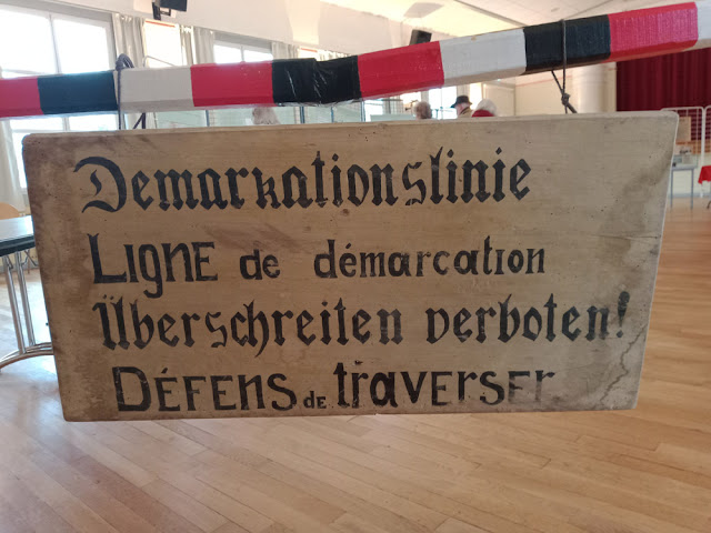
Recently Preuilly hosted a really interesting locally curated exhibition on the Ligne de la demarcation, the border between 'Free' France and Occupied France in the first couple of years of the Second World War. Our area, the Sud Touraine, was divided by this border and so experienced it up close and personally.
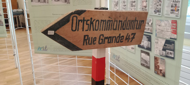
A sign pointing to German headquarters.
The following text is my translation of the introduction to the exhibition catalogue.
September 3 1939 was when the so called 'Phoney War' started for the French armed forces, most of which was restricted to the fortifications on the Maginot Line. On May 10 1940 the Wehrmacht descended on the Netherlands, Belgium, Luxembourg and the north-east of France.
The courage of the invaded countries' armies was not enough to stop the larger and better equipped enemy. There were numerous dead, wounded and prisoners from this Blitzkrieg. One month after this action, on June 14 1940, the victorious soldiers of the Third Reich marched in Paris, which had been declared an open city.
In France, the armistice was signed on June 22 1940 at Rethondes (Oises) in the railway carriage that symbolised victory in 1918 for the French and defeat for the Germans. The Hexagon* found itself parcelled up into zones and Article 2 of the Armistice agreement brought into being on June 25 a Demarcation Line between an Occupied Zone and a Zone known as 'Free' or 'nono' ('non occupée). The Government of the 'Free' Zone was installed at Vichy (Allier) with Marshall Pétain at its head. He took the title of French Chief of State on July 11.
La Demarkationslinie or green line owed its name to the colour of the line on the joint map from the Armistice agreement. The Germans had wanted that because in 1918 the territories on their soil which were occupied by the Allies were delineated by a green line. The text referring to this interior border delineated 43 occupied counties in the north and west, 34 in the 'nono' Zone and 13 cut in two. Indre et Loire belongs to this last group. A village could be crossed by this artificial boundary, like Cussay, and a number of farms woke up with their buildings on one side of the line and their land on the other. The first line didn't satisfy the occupying authorities and they decided to modify it to suit their aims. This took place in the night of December 14-15 1940, and a new definitive line was imposed on everyone.
This separation line was simultaneously political, military and economic.
Key dates in Preuilly sur Claise during World War II.
- June 1940 Preuilly was bombed and several days later the Germans entered the town and occupied it.
- July 1940 Preuilly was transferred to the 'Free' Zone.
- November 1942 the Germans invaded the 'Free Zone and by March 1943 they occupied all of France.
- July 1944 Resistance fighters in the forest were betrayed and ambushed by 1000 German troops with tanks in an action known as the Battle of Pechoire.
- August 1944 the Resistance and the Germans held a meeting with a view to brokering an agreement to ensure peaceful passage of retreating German troops. Preuilly's mayor acted as personal guarantor that the Germans would not be attacked (and was prepared to pay with his life if the Germans were not given safe passage by the Resistance).
- September 1944 Allied aircraft attacked the Germans hiding in the forests around Preuilly. The next week 180 000 retreating German troops passed through Preuilly.
- October 1944 the mayor was confirmed in his position and a new Liberation council was put in place.


No comments:
Post a Comment