On our trip to the south of France in June visiting the Pont du Gard was high on our list, one of our 'must sees'. It did not disappoint. We booked a guided visit online and were very pleased that we did. We had thought it was in English but it turns out they don't do many English language tours and it was in French. It didn't bother us in the slightest, but it is something to be aware of if you go there. Booking a guided tour is the only way of accessing the aqueduct level of the bridge.
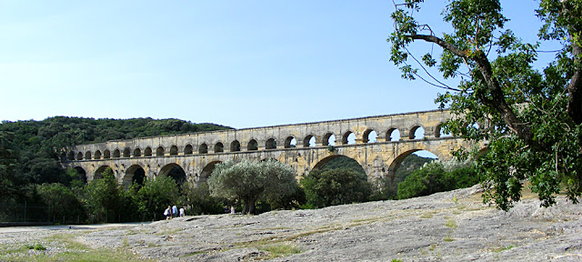
The Pont du Gard is a three level bridge carrying a Roman aqueduct on the third level. It is in Gard, between Uzes and Nimes, not far from Nimes. Probably built in the first half of the 1st century it allowed the aqueduct to traverse the Gardon River and get water from Uzes to Nimes. According to the latest research, it seems to have gone out of use as an aqueduct at the beginning of the 6th century.
In the Middle Ages and again in the 17th century the piles of the second level had a section removed to allow the structure to be used as a road bridge. This dangerously destabilised the structure, and the damage was eventually repaired in the 18th century. From the 16th century the exceptional architecture of the bridge attracted attention and it benefitted from regular restorations intended to preserve its integrity. An actual road bridge was built abutting the aqueduct in the mid-18th century. It is the highest aqueduct bridge known from the Roman world and is now listed as UNESCO World Heritage.
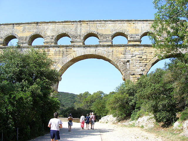
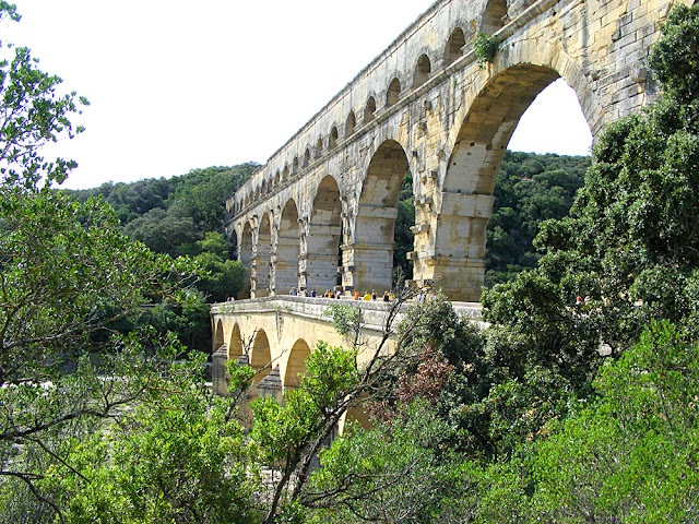
You can see the triple arches that form each of the second level arches in this photo, the road bridge added in the 18th century (now pedestrianised) and the projecting stones for supporting scaffolding.
The total length of the aqueduct that the bridge forms part of is 52 kilometres, 35 kilometres of which is underground, as is more typical of Roman aqueducts. It is testiment to the extraordinary engineering skills of those that constructed it. The fall from Uzes to Nimes is only 12.6 metres, and the distance between the two as the crow flies about 20 kilometres. However, the aqueduct has to snake about all over the countryside because of the lay of the land. In addition there was the challenge of making the structure strong enough to withstand the tremendous floods that the Gardon is prone to. Dating the structure is possible because of pieces of ceramics and coins found inside. It is estimated that a thousand workers must have laboured for 5 years to complete it. The gradient on the the aqueduct bridge itself is a fall of 2.5 centimetres in 456 metres. The gradient varies quite a bit along the route of the aqueduct, but the engineers were manipulating as best they could the extremely shallow fall, partly to be able to limit the height of the already exceptionally high bridge.
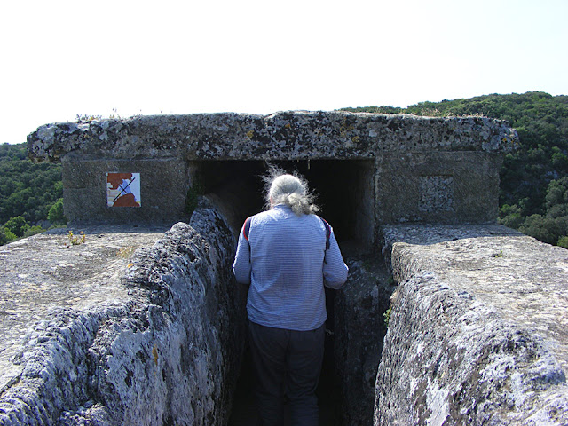
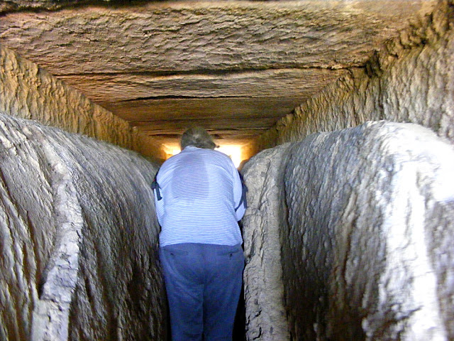
Simon entering the aqueduct channel on top of the bridge.
There are 11 million blocks of stone in the structure, weighing a total of 50 400 tonnes. They were hoisted into place by means of a 'squirrel cage' (a pulley system powered by a man walking on a treadmill). There was scaffolding supported by stones projecting from the bridge, and the arches were supported by wooden forms whilst under construction. Each of the big arches are constructed as multiple independent arches which abut one another. This technique of 'ring vaulting' was used on other Roman bridges too.
You can see in this photo how much the limescale has accumulated and constricted the conduit.
The aqueduct carried on average 400 000 cubic metres of water per day (460 litres per second). The water took a day to travel from the source at Uzes to the collection basin in Nimes. In fact, Nimes had several wells and a nearby spring, so the aqueduct was not a necessity, but rather a prestige project, to feed the baths, gardens and fountains in the town.
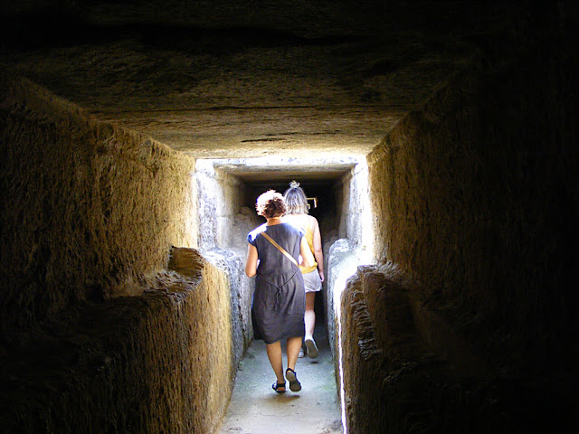
Fortunately I worked out quite quickly that if 'Topknot Woman' could walk through without bending, then so could I.
From the 4th century it ceased to be maintained and mineral deposits built up, reducing capacity by two thirds or even three quarters. The lack of maintenance probably coincided with the take over of Uzes by the Franks and of Nimes by the Visigoths. The aqueduct began to be used as a handy repository of building material.
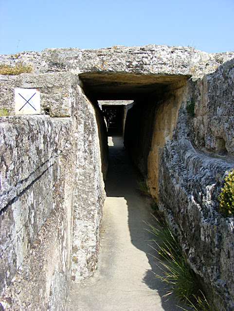
Looking back through the aqueduct.
The stone came originally from nearby quarries. On the exterior of the arches you can see stones which project, which were for supporting scaffolding as the bridge went up. The stones are marked to indicate their position and there are apparently some witch marks (phalluses scratched into the stone to ward away evil). We didn't see any of this, but there is plenty of graffiti all over the stones, put there by people over the centuries who have come to see the famous bridge. Many journeymen masons have left their mark on a structure they considered to be an obligatory stop on their traditional tour around France as they honed their trade. Those on an 18th century Grand Tour also considered it an obligatory stop, as did a number of French kings on tour with their courts.
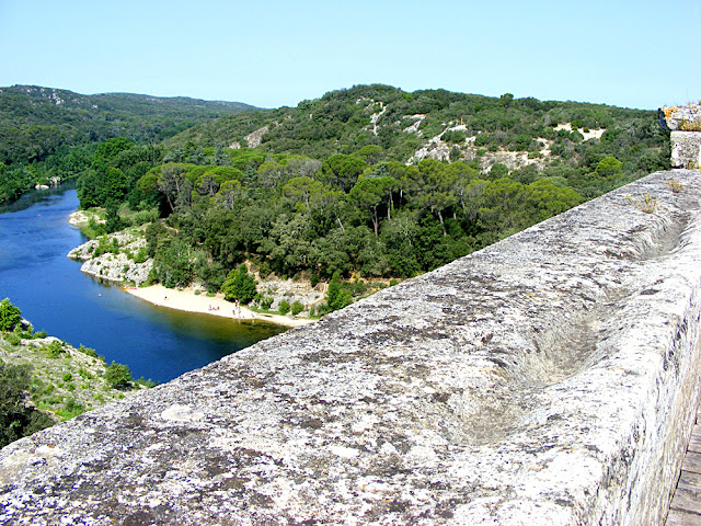
Looking downstream from the top of the aqueduct bridge. If I visit again I'll make sure to bring my swimsuit.
On the upstream side the wall of the bridge bulges out, a result of the expansion and contraction of the stones over a long period of time as the temperature changes. The bridge was constructed without mortar, and instead used oak tenons to lock together the blocks of stone, some of them up to 6 tonnes in weight. Only the upper level uses rubble stones held together with mortar. The stone used is a local shelly limestone, rather coarse, easy to cut and full of shells.
The groove in the top of the aqueduct bridge wall was made from thousands of feet walking across over the centuries. No guard rail. One side for crossing in one direction, the other side for crossing in the other direction.
The enclosed aqueduct channel is 1.8 metres high and was sealed with Roman lime based cement then painted with a reddish iron oxide limewash, which was to prevent the limescale in the water degrading the surface. It is big enough for a man to easily enter to do maintenance, a big part of which was removing debris and vegetation from the structure.
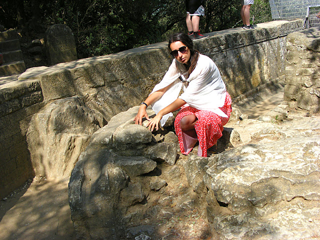
Our guide demonstrates the construction of the aqueduct channel. Everything to the left of her hands is limescale. She is indicating the rubble stones and mortar layer which is the actual construction. Between the two there is a narrow band of cement which seals the channel.
Despite the age and tribulations of the edifice, it has never suffered serious structural damage from the legendary Gardon floods. In 2002 the flood waters rose to three quarters of the way up the lower arches. In 1958 the waters rose all the way up to completely cover the lower level of the aqueduct bridge.
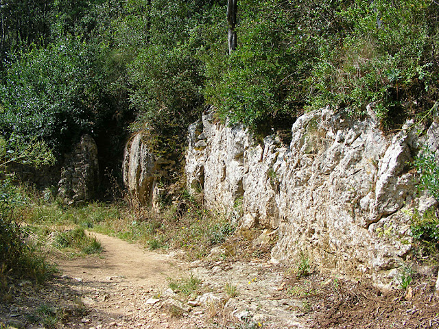
Some distance from the bridge the aqueduct dives off into the undergrowth.
From the beginning of the 21st century a lot of work has been done to improve the site, remove the tourist tat and protect it from the influx of visitors. There is a museum and the surrounding landscape has been carefully restored. Access to the site is by foot only, and access to the Roman aqueduct by guided tour only. It is one of the most visited heritage monuments in France, with about a million and a half visitors annually.


No comments:
Post a Comment